Old Rag Mountain Loop
A wooded climb, a hands-on granite scramble and a summit with views in every direction. From Skyland, plan on driving to the Old Rag parking area at the park boundary.
Park Service estimates
- Distance
- 9.4 miles
- Elevation gain
- 2,348 feet
- Hiking time
- 7½ hours
- NPS rating
- Very strenuous
Mileage and elevation from the GPX track
- Loop distance
- 9.20 miles
- Start and finish
- 934 feet
- Highest point
- 3,266 feet
- Cumulative climb
- ≈3,217 feet
The track reaches its highest point at mile 3.60, leaving about 5.6 miles to return to the trailhead.
Why do the elevation figures differ?
The 3,217-foot figure adds every uphill change between consecutive points in the AllTrails GPX export, including small fluctuations. The high point is 2,332 feet above the start. The National Park Service lists 2,348 feet of elevation gain for its published circuit.
Up the Ridge Trail
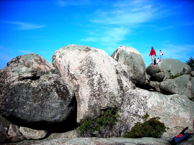
From the parking area, follow the blue blazes uphill through the woods. On the ridge the walking rhythm breaks: you thread between granite blocks and use your hands to pull up onto ledges. An early overlook feels like the top, but the summit is farther along.
Over the summit and down through the hollow
At the summit, the trees give way to open granite. The loop still has a long descent ahead: follow the Saddle Trail past Byrds Nest and Old Rag shelters, then turn onto Weakley Hollow Fire Road. The Ridge Access Trail leads back toward the parking area.

Circuit map
Open the full-size National Park Service map (PDF)
Planning a May hike
The park currently requires an advance Old Rag day-use ticket from March 1 through November 30, as well as park admission. Check the park’s ticket information before the trip.